 SPOKANE CITY
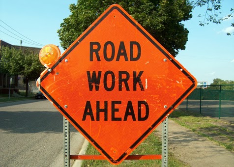
Chip Seal Work (Residential)- The residential chip
seal work around Comstock Park was not 100% completed due to a machinery
breakdown so work starts again today, Wednesday, July 6th, in the
afternoon to complete the other streets. Howard St. was completed and parking by
the pool should not be a problem on Wednesday the 6th.
Other chip seal work started on Kathleen Avenue (Indian Trail) yesterday. The road is completely closed to ALL traffic from 8 a.m. – 4
p.m. No Parking signs are in place.
Northwest Boulevard and Columbia Circle (CSO 6)- This project is substantially
complete. It included the
installation of a 900,000 gallon tank. New water mains will be added at H
Street, Glass Avenue and Columbia Circle these lines will be connected to the
new main along Columbia Circle. Columbia Circle, H Street and Glass Avenue will
be repaved and sidewalk repairs will happen in select areas. Many driveways
will be replaced to match the new street grade.
Wall Street, Main Avenue to Spokane Falls Boulevard- Wall Street from Main
to Spokane Falls will close Monday, July 11. Work will start at Main and Wall
heading north toward Spokane Falls. This work is to construct storm water improvements,
sidewalks, new asphalt pavement, traffic signal revisions, an irrigation
system, and add lighting.
Rowan Avenue Improvements from Driscoll Boulevard to Monroe Street- Ash Street from
Nebraska to Everett Avenues will be reduced to one lane from Monday, July 11 to
Friday, July 15 for paving of Rowan Avenue. This
project is for reconstruction work from Driscoll Blvd. to Monroe Street. The
project also includes installation of bike lanes, filling sidewalk gaps and
replacing water lines.
37th Avenue, Regal Street to Custer Street- 37th Avenue
from Freya to Custer Street will be closed starting Tuesday, July 5. 37th
will be closed at Havana Street. The detour route is Glenrose to Palouse Highway to Regal
Street. Freya is currently closed from 37th Avenue to the
Palouse Highway for work on Hazel’s Creek. When this work completes Freya
will be the detour route for the 37th Avenue closure. This work is to reconstruct the road,
including pavement replacement, curbs, sidewalk, bike lanes, stormwater piping,
and adding a water main.
Ben Burr Trail and Connection to the Centennial Trail- Work
continues along the trail at 3rd Avenue and Arthur and 2nd
Avenue and Perry. This
project will design and construct a shared use paved trail connection for
bicyclists and pedestrian as well as security lighting installation. The
project will be from the Centennial Trail at the Gonzaga Bridge southeast of
Erie Street and continuing to Liberty Park where a connection will be made to
the existing Ben Burr Trail. The trail will then continue on the existing
Ben Burr Trail to the trailhead immediately south of Underhill Park.
Bridge Avenue and Monroe Street CSO Work- Summit Blvd./Bridge
Ave. is closed to traffic. Lincoln has one northbound lane
open. Lincoln southbound is closed at Broadway with local access
maintained to Anthony’s restaurant and parking lots. This
project will construct a Combined Sewer Overflow Tank (CSO) tank and the
necessary piping for our Cleaner River Faster Program.
Hatch Road Grind and Overlay Work- Streets Crews are grinding Hatch Rd. working downhill from 57th
Avenue. There will be lane restrictions and some delays at times.
Hazels Creek Stormwater Treatment Project- Freya
Street is closed from 37th Avenue to Palouse Highway until mid-July.
Work continues on Freya
south of 37th Avenue. Paving is scheduled early in the week. Construction
of a stormwater treatment system with disposal ponds and stormwater piping is
beginning.
High Drive Phase II, Bernard to Grand Street Repair Work- Repairs
to the storm sewer will go to Thursday, July 7.
Lane restrictions will be in place at High Drive and Lamonte and High Drive and
Manito. Flaggers are on site to
direct traffic.
Indiana Avenue from Dakota to Perry Street- Limited
construction activities will begin Tuesday, July 5. Full construction should
be underway Monday, July 11, proceeding from East to West. Indiana Ave.
from Dakota St. to Perry St. will be closed with East-West traffic detoured to
Mission Ave., Montgomery Ave. and Illinois Ave. North-South arterials
within the construction zone at Hamilton Ave. and Perry St. will remain open. This
project includes curb ramps, storm swales, new curb, waterline replacement,
signal installation work and some parking removal.
Main Avenue and Division Street Intersection Improvements- Work continues on
sidewalk removal and excavation for underground storm water improvements.
Pedestrian detours will be in place. Work
on this project involves curb bumpouts at all four corners of Division Street
and Main Avenue, the removal and replacement of existing curbs, gutters, and
sidewalks, ADA upgrades, installation of planter boxes and planting.
Monroe/Lincoln Street Couplet, 8th
Avenue to 2nd Avenue- Work on Monroe Street
from 4th Ave. south to 8th Ave. continues. Monroe and Lincoln are closed completely to traffic. Detours are in place. The current two way traffic on Lincoln will remain open
between 4th Avenue and 6th Avenue to provide access. Access along
7th will be provided through the work zone, but will be on unpaved
surfaces. There may be times when access along 7th Avenue will be
restricted to limited hours during the day. Monroe between 14th and 8th
Avenue will remain open for local traffic to serve the businesses and residents
in that area.
The detour for through traffic is along 14th Avenue and Bernard/Washington/Stevens and 2nd and 3rd Avenue. This phase of
construction is expected to last 3 to 4 weeks. Once this phase is
complete, Monroe will be opened to traffic southbound. Northbound traffic
will continue to be detoured until the project is complete.
This
project reconstructs the roadway from 8th to 2nd Avenue
and installs storm water and water facilities.
Monroe and Lincoln Street, Main Avenue to 2nd Avenue- Work is
underway. Monroe
has two open lanes of traffic on the west side of the street. Four
way stop signs are located at the intersections of 1st, Sprague, and Riverside
Avenues. This is a full depth roadway replacement and full depth
replacement between curbs on Lincoln Street and Monroe Street; Main Avenue from
Monroe Street to Lincoln Street; and Monroe Street from Spokane Falls Boulevard
to Main Avenue. Some minor curbing and ADA curb ramps will be installed where
necessary.
Northwest Boulevard and Columbia Circle (CSO 6)- Construction of catch
basins and drywells in the following intersections has begun: Wellington and Cora
(both Coras), Park Blvd. and Cora, Sheridan Court and Cora. This project includes the installation of a 900,000 gallon tank. New water
mains will be added at H Street, Glass Avenue and Columbia Circle these lines
will be connected to the new main along Columbia Circle. Columbia Circle, H
Street and Glass Avenue will be repaved and sidewalk repairs will happen in
select areas.
Pettet Drive/TJ Meenach Combined Sewer Overflow (CSO 12) Project- Work is underway and
Pettet Drive is closed to traffic until November. The clover leaf that
services TJ Meenach, Down River and Pettit Drive (three out of the four
legs) is open. The leg that comes off
of Pettit northbound re-directs citizens to Northwest Blvd. Vehicles traveling southbound on Down River Drive have two options; enter onto TJ Meenach or continue under the bridge and turn
uphill to Northwest Blvd. This
project will build a 690,000 gallon storage facility and connections to existing
CSO Basin 10 outfall. Work also includes repaving of Pettet Drive and
pedestrian/bike trail construction.
Rowan Avenue Improvements from Driscoll Boulevard to Monroe Street- Phase II
of Rowan from Alberta to Monroe Street is underway. Rowan Avenue from Alberta to Ash Street is closed. The intersection of
Albert and Ash is open to north and southbound traffic. The intersection of Belt and Rowan is closed to traffic for
the duration of the project. This project is for reconstruction work from Driscoll Blvd. to
Monroe Street. The project also includes installation of bike lanes, filling
sidewalk gaps and replacing water lines.
Wall Street, Main Avenue to Spokane Falls Boulevard- Wall Street from Main
to Spokane Falls is closed. Work will start at Main and Wall
heading north toward Spokane Falls. This work is to construct over 100 feet
of storm sewer, five drainage structures, sidewalks, new asphalt pavement,
traffic signal revisions, an irrigation system, and ten luminaires.
SPOKANE COUNTY
Market Street (Parksmith to Farwell)-Rehabilitating the roadway after installing sewer and fiber optics. The road is open to traffic but there are possible lane restrictions.
Seven Mile Bridge & Seven Mile Road- A detour is in place while this bridge is being demolished and rebuilt. The temporary speed limit is 25 mph.
Hawthorne Road West (Waikiki to US395)- The road is closed until late August for road rehabilitation, stormwater drainage swales, tree planting, signal improvement, bike lane installation and striping.
Hawthorne Road East (US395 to US2)- The road is closed to traffic, with street parking prohibited, for roadway rehabilitation, installation of stormwater sand filters, curbing, a traffic signal, bike lane and striping.
Houston Road from Colville Road to Grove Road- Crews will be working on ditching, culvert and shoulder work during day hours only. No detours in place and road will remain open to local traffic, bus traffic and emergency vehicles around the clock. For all other traffic, the road will be closed from 6:00 a.m. to 5:00 p.m.
SPOKANE VALLEY32nd
Avenue from Dishman-Mica Road to University Road- Closed through mid-August for street preservation work. Signs detour traffic via Dishman-Mica Road and University Road.
32nd
Avenue from University Road to Pines Road- Reduced to one lane in each direction through mid-August. The north
sidewalk is closed.
Fancher
Road between Trent Avenue and Sharp Avenue- Traffic is reduced to one lane in each
direction through early July.
Indiana
Avenue and Evergreen Road Intersection- Through July
29, Indiana westbound is reduced to one lane and one left turn
lane, with Indiana eastbound reduced to two lanes with right turns permitted
from the curb lane. Evergreen northbound is reduced to a single lane
with turns permitted in both directions.
Southbound Sullivan Road Bridge across
the Spokane River- Traffic is reduced to one lane northbound and two lanes southbound. Turns from Indiana
Avenue onto northbound Sullivan Road are reduced to one lane. Southbound Sullivan
Road at Flora Pit Road is reduced to one lane, July 5-July 8, from 6 a.m. to 2 p.m.
WSDOT
US 2/Sunset Blvd. to I-90- Weekday evenings from about 7
p.m. until as late as 6 a.m. the following morning, drivers should be alert for
lane restrictions as crews upgrade guardrails.
US 2-Division Street/Curb and Sidewalk- Northbound Division Street is
reduced to two lanes. Drivers may experience congestion and some
delays as crews improve sidewalks and curbs.
I-90/Westbound Freya
Off-Ramp- Westbound drivers should be alert for narrow
shoulders. All ramps open. Expect lane restrictions on 2nd
Avenue as crews construct a new westbound Freya Street off-ramp approximately
¼ mile to the east of the current ramp.
US 395-Division Street/Hawthorne
Rd. Intersection-Wednesday through Friday, July 6-8, from about 6 p.m.
until as late as 6 a.m., Division Street will be reduced to one lane in each
direction with some slow traffic and congestion. Following that work, Hawthorne
road will be closed east and west of Division. Crews are making intersection improvements and installing a new signal system.
No comments:
Post a Comment