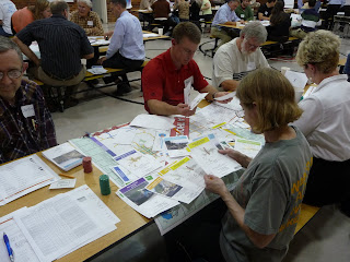
 As I've been talking about for weeks, last night was the community workshop for SRTC's Transportation Vision Project.
We had a good turnout, with people divided up into groups to play '1000 Visions- A Transportation Vision Game.' And while it sounds kind of cheesy, it was actually fun and kind of eye-opening. The goal was to determine what kind of taxes to approve, which dictates what your budget is for transportation. Then you move around a gameboard, stopping on each square with a project name on it.
 For instance, if you land on the North Spokane Corridor, you have to decide if you want to spend $315,990,000 to complete the project. If you decide to fund it, that money comes out of your budget and you have less money for other projects down the line.
 I work with people in the tranportation field every day, so it was interesting to hear a group of 'civilians' discuss why or why not they would fund certain projects. For instance, on the NSC, my group (who were VERY fiscally conservative) decided to fund it to spur economic growth, not because they want a way to get north and south quicker.
  The group decided against 'north-south' and 'east-west' connectivity projects because they said the freeway and north Spokane Corridor will take care of those issues. And they went with most of the trails and pedestrian options because they are inexpensive.
 The game will be put online within the next few weeks so those who couldn't make the workshop can give it a shot. I'll post it then. Until then, do any of you that attended the workshop have anything to add? Did you find this exercise useful?

4 comments:
Well it was fun, but I hope it helps figure out where and what to spend all the money on in the next 20 years. I was surprised a few did not know what Bridging the Valley was, and that some had not heard about the Northwest loop around the city.
A few at my table weren't familiar with the Fish Lake Trail. I always forget that not everyone lives and breathes this stuff everyday.
We had more fun than the frowny expression on my face in the last pic suggests!
As someone who serves on the team advising on how to engage people in this process I was glad to see people I've never seen at other public meetings--new faces mean new ideas.
However, I think the game falls short of what we hoped for. We wanted people to think FIRST about what kinds of communities they want to live in, then what types of transportation projects will support and connect those communities.
In playing the game it came down to prioritizing specific projects without anything that cued us to think about the larger effects of those projects.
We did get some of that discussion but not as much as I'd hoped. At the end the output that tells us the distribution of values expressed through choice of projects was really interesting. It would be cool to see if you could essentially play the game "backwards": choose which values you want to maximize and see which projects that would prioritize.
Our table was highly skeptical of any projects that are merely conceptual and that lack detail. "Will it come through my neighborhood?" was a typical question. Lack of familiarity with a project mostly doomed the project on our team.
The web version needs to address both these issues. Information people can choose to read about specific projects is easy enough. I don't know how you add in the prompt with enough information to get them thinking about land use issues first, transportation second, but that really needs to happen.
Our community vision for the future isn't "about" roads. It's about where we want to live and how people and goods can move safely and efficiently using all modes of transportation.
@BarbChamberlain
I took your 'frowny' look to be one of concentration Barb. I'll pass your comment on to our consultant team and see if they can figure some way to work in a 'background piece'- such as adding the pros and cons of each sample project to the information sheet about that project or include an 'introduction' to read through when the game goes on online so that players can read about the role of land use planning in the process before they start the game. We'll do some brain storming and see what we can come up with.
Post a Comment